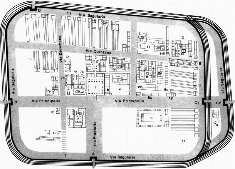
Haltern, Map
Description | Haltern, Map |
Date | 5 BCE–ca. 17 CE |
Creator | |
Source | Scan from T. Bechert & W. Willems, Die römische Reichsgrenze zwischen Mosel und Nordseeküste (1995) |
Linked | |
Categories | |
Tags |
We share high-resolution versions of our original photographs. Contact us for further information and be sure to make a note of the URL of the photos you are interested in.