Thermopylae (Greek: Θερμοπύλαι; "Hot Gates"): small pass in Greece, site of several battles, of which the Spartan defeat against the Persian invaders in 480 is the most famous.
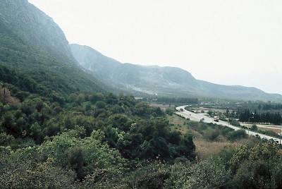
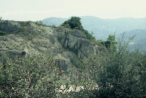
Thermopylae, view from electricity mast
In the seventh book of his Histories, Herodotus offers a description of the topography of the battlefield of Thermopylae. The interpretation poses no problems, but there is one oddity. In reality, the road is essentially from the west to the east, as you can see on the satellite photo above, but Herodotus presents it as if it is from the north to the south.
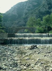
Thermopylae, Asopos
This is not as strange as it seems, however, because any traveler visiting Thermopylae was moving from Thessaly and Malis in the north to Doris and Locris in the south (or the other way round).
From the river Melas, it is a distance of about a kilometer to the city of Trachis. The parts on which Trachis is situated are the widest portion of the entire region, as regards the space from the mountains to the sea; for the plain has an extent of 2200 hectare. In the mountain-range which encloses the land of Trachis there is a cleft to the south of Trachis itself; and through this cleft the river Asopos flows, and runs along by the foot of the mountain.
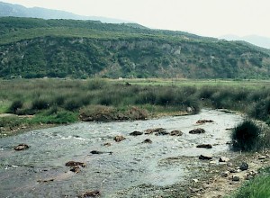
The river Phoenix
There is also another river called Phoinix ["the red one"], to the south of the Asopos, of no great size, which flows from these mountains and empties itself into the Asopos. Behind the river Phoinix is the narrowest place, for here has been constructed a road with a single wheel-track only. Then from the river Phoinix it is a distance of three kilometer to Thermopylae; and between the river Phoinix and Thermopylae is a village called Anthela. The river Asopos flows along Anthela before it runs out into the sea.
Behind this village is a wide space [near a sulfurous spring] in which is set up a temple dedicated to [the goddess] Demeter of the Amphictyons, and there are seats for the Amphictyonic councilors and there is a temple dedicated to Amphictyon himself.note[Herodotus, Histories7.199-200.]
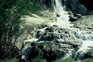
The hot spring
The sulfurous spring was later converted into a bathhouse by Herodes Atticus. In his narrative about the battle, Herodotus tells more about the topography of Thermopylae, which was a narrow strip of land between the mountains and the sea, fortified with an ancient wall parallel along the road, which was excavated in 1939. Today, it is hard to imagine that the sea once reached as far inland as the modern road (cf. this photo). On the photo to the left, the Trachinian plain (Xerxes' camp) can be seen in the background. Behind the position of the photographer (who climbed into an electric pylon) is a rock called "Black Buttocks", which is mentioned in Herodotus' description of the mountain path.
Black Buttocks
This path lies as follows: it begins from the river Asopos, which flows through the cleft, and the name of this mountain and of the path is the same, namely Anopaia; and this Anopaia stretches over the ridge of the mountain and ends by the town of Alpenos, which is the first town of the Locrians towards Malis, and by the stone called Black Buttocks and the seats of the Kercopes, where is the very narrowest part.note[Herodotus, Histories7.216.]
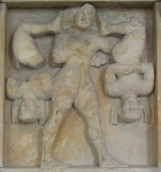
Heracles and the Kercopes (Selinus, temple C)
The Kercopes, "monkey men", were two kobolds living in these mountains. They did a lot of evil to humans, as an unidentified poet, quoted in the Suda dictionary, says:
Liars and cheats, skilled in deeds irremediable,
accomplished knaves.
Far over the world they roamed deceiving men
as they wandered continually.
They knew that they had no one to fear, except for an enemy with dark hinder parts. One day, they were captured by Leonidas' ancestor Heracles, who hung them upside from a yoke he carried on his shoulders. From this uncomfortable position, the Kercopes found out that Heracles was the enemy against whom their mother had warned them.