Ensérune
Q77221Ensérune: Celtic hillfort in southern France, main settlement in the Languedoc.
Ensérune I
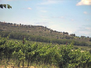
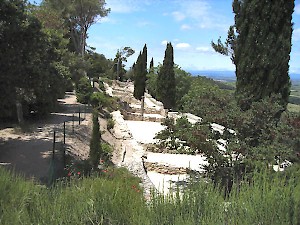
The hillfort at Ensérune - its ancient name is not known - was built in the mid-sixth century BCE, on a long ridge with very steep slopes, which rose about 100 meter above a fertile plain. The platform on the summit measures 600 meter from east to west and 150 meter from north to south. To the north, the large marsh of Montady offered additional protection against enemies; it is hard to recognize it today, because it was drained in the thirteenth century.
The original settlement - or oppidum, to use an expression from the archaeological jargon - consisted of simple mud-built huts with grain pits. It was influenced by both the Mediterranean cultures and the Iron Age cultures of Central Europe that are usually known La Tène or "the Celts".
Ensérune II
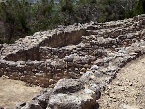
After a century and a half of occupation, after c.425 BCE, it became a real town ("Ensérune II"), with square houses made of stone, straight roads, and a rampart. In the western part of the ridge, a necropolis with many urns has been identified. The alphabet used to write graffiti suggests ties to the towns along the Catalan coast.
This town was open to trade with the Mediterranean world, for which it was well-situated: it's about fifteen kilometer to the coast, close enough to have access to the trade networks, and sufficiently distant to be protected against raiders. Agde may have been an important port. Originally, Greek products were popular, as can be deduced from the black glazed wares from Campania and the Attic red figured ceramics that were found in the necropolis. Later, Italian black wares became popular. Ensérune may have played a role in the metal trade; ores were found in the Montagne Noire.
The area was conquered by the Romans in the first years of the Second Punic War (218-202; "the war against Hannibal"); a destruction layer marks the beginning of the phase known as Ensérune III.
Ensérune III
For the Romans, the town was important as a stage along the land road to Hispania, which was developed by Gnaeus Domitius Ahenobarbus in 118 BCE and called Via Domitia. It is certain that at first, the people of Ensérune retained their close commercial ties with the Catalan coastal towns.
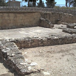
Contacts with Italy, however, soon intensified and superseded the Catalan ties, especially after the colonia of Narbo Martius (modern Narbonne) had been founded about twenty kilometer to west of Ensérune. Houses became more elaborated and often had Italian designs, with an inner court (peristyle), mosaics, and columns in the Doric or Ionian orders. One public building, incorrectly called the "Château d'eau", has been identified. In the west, a deep ditch was dug to protect the only vulnerable part of the fortification.
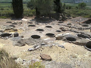
At some point in the first century BCE, the city was abandoned and the people started to live in the settlements in the plain. Essentially, the site had been eclipsed by Narbo. Only the artisans' quarter, where a foller had his workplace, remained in use until the first century CE.
 Ensérune, Artisans' quarter |
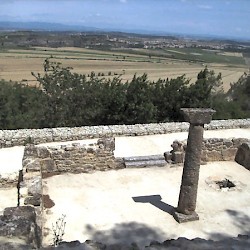 Ensérune, Maison à la colonne |
 Ensérune, Dolia |
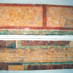 Ensérune, Wall [painting (first Pompeian style) |
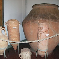 Ensérune, Amphoras and dolia |
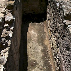 Ensérune, Roman cistern |
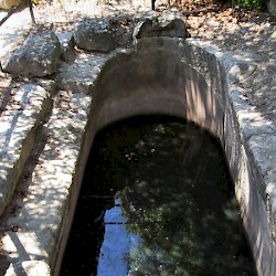 Ensérune, Roman cistern |
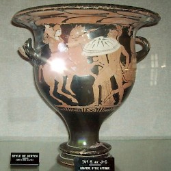 Ensérune, Attic krater with amazonomachy |