Erebuni
Q733610Erebuni: ancient name of modern Yerevan. There are several archaeological sites: Shengavit, Erebuni (from which the name "Yerevan" is derived), and Karmir Blur.
Although the Ararat Plain, the central region of modern Armenia, has a rather extreme climate with cold winters and hot summers, it is one of the oldest continuously inhabited regions in the world. One of the main settlements is Yerevan on the eastern bank of the Hrazdan River. Flowing from Lake Sevan in the north to the Araxes in the southwest, it connects Yerevan to the Caspian Sea and has allowed the inhabitants of the Ararat Plain to trade, to catch fish, and to irrigate the land.
Archaeologists have identified several sites: in the Chalcolithic Age and Bronze Age, people lived at a place called Shengavit; in the Early Iron Age, Erebuni (modern Arin Berd) was an important settlement; after c.650 BCE, it was replaced by Theisebani (modern Karmir Blur), which was abandoned for Erebuni when the Achaemenid Persians conquered the area.
Shengavit
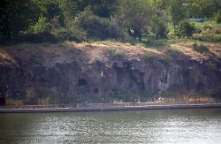
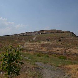
The site known as Shengavit is situated on a platform that rises about thirty meters above the Hrazdan River. Archaeologists recognize four main occupation levels, which belong to the "Kura-Araxes Culture", the main Chalcolithic/Early Bronze Age culture of Transcaucasia.
- IV: c.2300 BCE - c.2000 BCE
- III: c.2600 BCE - c.2300 BCE
- II: c.3000 BCE - c.2700 BCE
- I: c.3500 BCE - c.3000 BCE
The people lived in round houses with square adjoining rooms. Among the finds are axes, arrowheads, pottery, objects made of bone (spindles, needles...), and objects made of stone (obsidian, basalt, flint). The bones of cattle and fish inform us about the diet of the inhabitants, while the spindles and needles are evidence for textile making.
In the second half of the third millennium BCE, the site was (for unknown reasons) gradually abandoned, but there were still people living in the neighborhood, because Shengavit remained in use as cemetery for some time. Something similar happened at Garni. Evidence for the Middle and Late Bronze age, though, is rare.
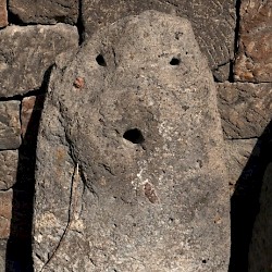 Shengavit, Idol |
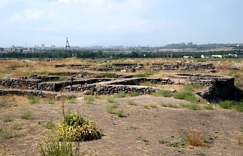
 Shengavit, Round structure |
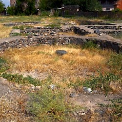
 Shengavit, Sanctuary |
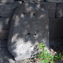 Shengavit, Idol |
Arin Berd (Erebuni)
In about 782 BCE, king Argište I of Urartu founded Erebuni (modern Arin Berd), an impressive fortress on a steep hill near a small river that emptied itself in the Hrazdan River, four kilometers to the west. (Urartu was an Iron Age kingdom with Tušpa near Lake Van as capital.) The text of the foundation inscription has survived:
By the grace of Khaldi, Argište son of Menua, built this powerful fortress and called it Erebuni. He did so for the glory of Urartu and to instill fear among the enemies. Argište says: before the great monuments I built, this was a waste land. By the grace of Khaldi, Argište son of Menua, is the mighty king, king of Urartu and ruler of Tušpa.
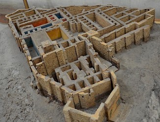
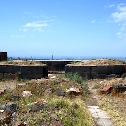
The fortress, the name of which perhaps means "victory", consisted of a palace, store rooms (a/o six wine cellars), and religious buildings. Among the sanctuaries, temples of Khaldi and Ivarša have been identified. There are indications for a ziggurat (temple tower). The complex was surrounded by walls that even today are quite impressive.
During the reign of king Rusa II (mid-seventh century), Erebuni was destroyed by an earthquake. The residence was transferred to Karmir Blur.
 Erebuni, Wheel of an Urartian Potter |
 Erebuni, Apadana |
 Erebuni, Susi temple of Ivarsha |
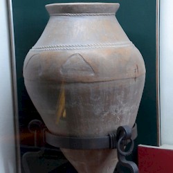 Erebuni, Urartian pithos |
Karmir Blur (Teishebaini)
Karmir Blur was founded by king Rusa II (mid-seventh century BCE), on the east bank of the Rhazdan River, about seven kilometers west of Erebuni. It was named after Teisheba, the Urartian god of war. The city consisted of a Lower Town and a citadel, surrounded by two walls: the builders were aware of the threat from Assyria, Urartu's increasingly powerful southern neighbor.
A visitor would enter the citadel through its southern gate, which was directed towards Mount Ararat. A northern gate may have led to the river. East of a large central square were rooms on two levels: at the lower level were store rooms, while the upper level was used as a palace. Among the finds were many cuneiform tablets with sacrificial texts. To the southwest of the citadel, several buildings of the Lower Town have been excavated. Even further was a cemetery, which dates back to the Bronze Age.
Towards the end of the seventh century BCE, the city was sacked by people attacking from across the river, using Scythian arrows. This fits a more general pattern: several other Urartian sites (e.g., Çavustepe) were destroyed in the late seventh century.
The identity of the enemy cannot be established: Scythians, Cimmerians, and Medes are likely candidates but it is also possible that Urartu survived the crisis at the end of the seventh century. The sixth century BCE is, at the moment, not very well-understood and it may well be that Urartu is the unknown kingdom destroyed by the Achaemenid king Cyrus the Great in 547 BCE.note In any case, the cemetery remained in use in post-Urartian times.
The modern name, Karmir Blur, means "red hill" and refers to the reddish bricks of the ancient walls, which still stand five to seven meters high.
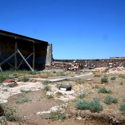
 Karmir Blur, General view |
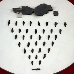 Karmir Blur, Scythian arrowheads |
 Karmir Blur, Water conduit |
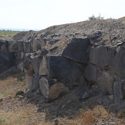 Karmir Blur, Wall |
Achaemenid Period
Whatever the precise course of events in the sixth century BCE, we are sure that Urartu, now called Armenia, was a satrapy of the Achaemenid Empire by c.520 BCE. Although Tušpa, the capital of old Urartu, may have been the residence of the satrap, it seems that a reoccupied Erebuni gradually became more important. At the same time, the old Urartian language was replaced by Armenian, which was related to Old Persian.
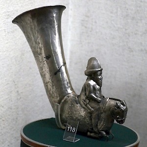
In Erebuni, some adjustments were made to the residence. Archaeologists have identified an apadana (Persian throne hall), while many finds prove Persian presence in the ancient fortress. Wall paintings and silver rhytons document a fabulous wealth. Among those who resided over here must have been Artašata, who was to become king of Persia under the name of Darius III Codomannus (r.336-330). During Darius' ill-fated reign, the Macedonian king Alexander the Great conquered the Achaemenid Empire and Armenia regained its autonomy. The rulers of Erebuni became independent dynasts.
In 188 BCE, Erebuni was replaced as residence by Artaxata,note twenty kilometers to the south, close to the Araxes River. After this, Erebuni disappears from the historical record, although there is some archaeological evidence for continued occupation.
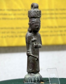
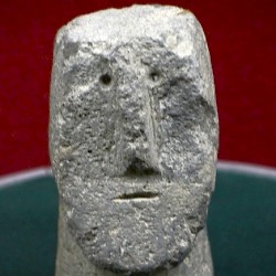 Yerevan, Urartian idol |
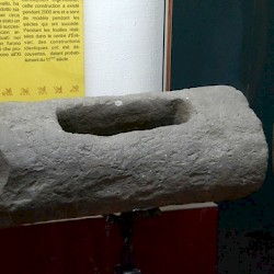
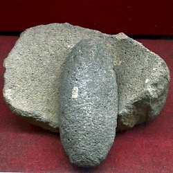 Yerevan, Urartian Mortar and Pestle |
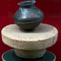
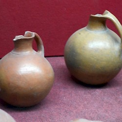 Yerevan, Urartian Pottery |
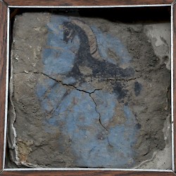 Erebuni, Achaemenid Wall Painting |
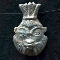 Amulet of Bes from Erebuni |