Bargylus
Q978233Bargylus Mountains: mountain range in western Syria, now known as An-Nusayriyah.
The eastern shore of the Mediterranean is the place where the African Plate collides with the Arabian Plate. As a consequence, there are large mountains. From north to south, they are called the Amanus Mountains, the Bargylus Mountains, the Lebanon, and the Mountains of Judah.
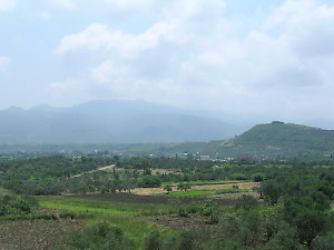
The Bargylus, about 120 kilometer from north to south and about 30-40 kilometer from east to west, is demarcated by the river Orontes: it has its sources in the Lebanon and flows north through a valley east of the Bargylus, turns west near Antioch, and empties itself in the sea. The valley southwest of Antioch is the division between the Bargylus and the Amanus. To the south, the Bargylus is separated from the Lebanon by the valley of the Nahr el-Kebir.
The Bargylus blocks rains coming from the west, which pour down on its forest-covered slopes, where the water can be used for irrigation. This made it possible to feed the city of Laodicea on the coast. East of the mountains is the fertile plain of the river Orontes.
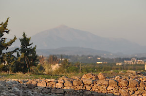
One of the spurs of the Bargylus was once known as Mount Saphon, Hazzi, or Kasion. It is about 1770 meter high, and was believed to be the seat of the supreme god Ba'al. The Greeks called him Zeus Kasios.