Halys (Kızılırmak)
Q257785The Halys ("salty river") or Kızılırmak ("red river"), east of Ankara, the longest river of Asia Minor.
The river has a length of 1150 km and is first mentioned in the Greek sources by the Athenian playwright Aeschylus. According to a famous story told by Herodotus of Halicarnassus, in c.547 BCE, the Greek scientist and philosopher Thales of Miletus changed the course of the river in order to facilitate the crossing of an army of the Lydian king Croesus.note
When Croesus crossed this river, it meant war with the Achaemenid king Cyrus the Great. In 585, Croesus' father Alyattes had concluded a peace treaty with the Median leader Astyages, and they had agreed that the river was the border between the two zones of influence. Cyrus thought he was the successor of the Median empire.
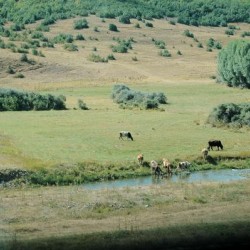 Halys (Kizil Irmak), Upper valley with cattle |
 Halys (Kizil Irmak), Gulleys along the river |
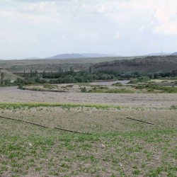 Halys (Kizil Irmak) near Gülsehir |
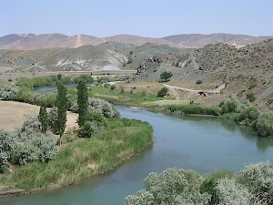
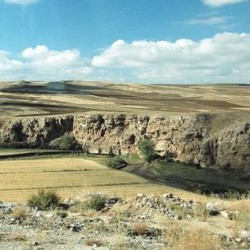 Halys (Kizil Irmak), cutting itself through the Anatolian platform |
The river has its source in ancient Armenia in the Kizil Dagi, and flows in a wide arc to the southwest, cutting itself into the rocky Anatolian platform. There are many lakes near the eastern part of the river and several tributaries, of which the sacred wells at Sivas (ancient Sebastia) are the most remarkable.
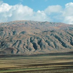
Everywhere, the river gains water from rainfall. These hills, east of Sivas, have been heavily eroded, and no doubt the soil that was washed down was carried away by the river, and eventually deposited somewhere along lower Kizilirmak. You can also see that the valley itself is wide (it is filled with deposits), which explains why the Upper Halys was one of the main roads in Anatolia, connecting Sebastia to Satala.
Turning to the west, it separates Cilicia from Cappadocia; again turning to the north, it divides Cappadocia and Phrygia. Finally flowing to the northeast, it empties itself in the Black Sea in Paphlagonia, where it forms a large delta. The Greek name Halys is probably derived from the salt deposits in Ximene.