Tigris
Q35591Tigris (Greek Τίγρις): one of the main rivers in Mesopotamia.
Our word Tigris comes from an Old Persian word that can be translated as "fast" or "arrow-like". The ancient Sumerians called the river Idigna, and in the Akkadian language that was spoken in Babylonia and Assyria, its name was Idiqlat.
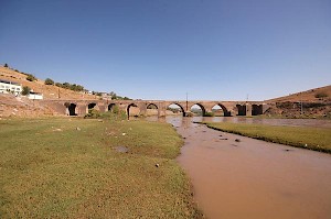
The Tigris is about 1,850 km long and rises in the eastern Taurus mountain range, or Armenia, as it was once called. Flowing in a generally southeasterly direction, it passed along Amida (modern Diyarbakır), where the Royal Road from Assyria to Anatolia crossed the river, and along Nineveh and Aššur. It accepts the waters of the Batman, the Great and Little Zab, and the Diyala. At the confluence with the latter, the city of Opis was built, which is more or less identical to modern Baghdad. This is the point where the river becomes navigable for shallow-draft vessels; higher upstream, the Tigris is too irregular, although rafts can reach Nineveh.
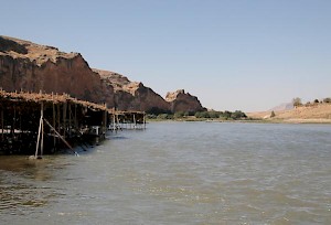
At Opis, the river reaches the alluvial plain of Babylonia, and turning to the south, it changes into a meandering river. There are not many great cities, because the river is subject to flooding. After all, it receives its water from the mountains of Armenia, where the snows melt in March. The Tigris flood reaches Babylonia in May-June, which is at a very unlucky moment, because the harvest is in April. Besides, the flood of the Tigris, which receives rain water from the Zagros through its tributaries, can be extremely violent and unpredictable, and can hardly be controlled. The result is that already in the fourth millennium, people were building dikes and digging canals. It is often said that this was one of the roots for the rise of cities and monarchies.
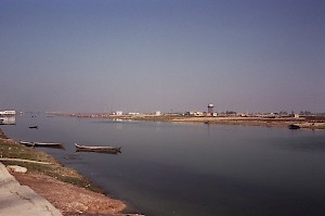
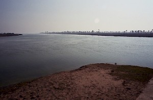
Today, the rivers Tigris and Euphrates unite some 165 km northwest of the shore of the Persian Gulf; their united course is the well-known Shatt al-Arab, not far from the ancient city Charax.
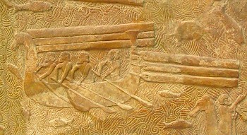
The reconstruction of the ancient landscape is something of a puzzle. Several scholars have claimed that the shore of the Gulf was much more to the northwest, because Sumerian texts say that Eridu was close to the sea; on the other hand, geologists have shown that the shoreline has not really advanced or receded. Probably, the area was very marshy, and there were large, brackish lakes. This is confirmed by the fact that in Eridu, fish bones have been found of a species of bass that does not live in a salty climate.
Because the water of the Euphrates and Tigris is comparatively salty, there is always the risk of salination. An interesting historical example can be found in the land of Lagaš, which produced a lot of wheat in c.2400 BCE (16% of the entire harvest); three centuries later, the land had become too brackish for this product (2% of the harvest); and after 2000, it was no longer possible to produce wheat.