Euphrates
Q34589Euphrates (Greek Εὐφράτης): river in ancient Mesopotamia.
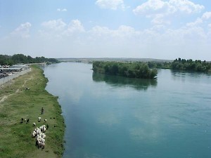
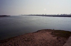
The Euphrates is the longest river of the Near East: it is about 2,760 kilometers long. The ancient Sumerians called it Id-Ugina, "the blue river", while the Babylonians and Assyrians called it Purattu. Its two sources and upper streams are in what was once called Armenia; these rivers, now called Kara Su and Murat Su, unite near ancient Melitene. Here, the Euphrates - full of rocks - passed through a range of high mountains, the western part of which was called Taurus (or Antitaurus) and is famous for Nemrud Daği, which oversees the Euphrates. This was the natural frontier between Armenia and Cappadocia.
To the south of the mountains, the country opens itself. The river enters the region that used to be known as Mesopotamia. The northern part is fertile and was dominated by very ancient cities like Samosata, Edessa, and Harran - the latter two situated on the banks of the Khabur, a tributary of the Euphrates.
At Zeugma, "bridge", the river was crossed by the main road from Assyria through Mesopotamia to Cilicia and Syria. The river is now becoming navigable for large ships. Following the meanders, merchants could reach Babylon. During the Achaemenid age, the east bank was called, in Aramaic, beyhn nahrîn, which is translated as Mesopotamia, "between the rivers" (the other river being the Tigris). The west bank was called eber nâri, "across the river", or Syria.
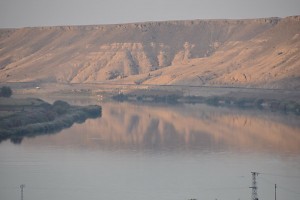
The country between Karchemish and Sippar, the northernmost city of Babylonia, is essentially a green corridor, about 20-30 km wide, through a desert. At some places, the river breaks through a low range of hills (e.g., near the Byzantine fort called Zenobia).
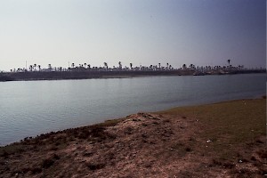
Throughout history, the towns were heavily fortified. After Sippar, which produced bitumen, the Euphrates reached Babylon. More to the west, there was a canal called Pallakattu, which was opened during the river flood. (As the Euphrates receives its water from the Armenian mountains, it is subject to flooding in May-June, during the harvest.) A second canal, known as the Royal River, carried water to the Tigris and joined this river near Opis. Downstream from Babylon was Ur, close to the sea, which has receded in the past centuries.
Because the water of the Euphrates is comparatively salty, there is always the risk of salination in Babylonia. Yet, with the necessary care, the alluvial plain can be extremely fertile, and it is often said that this is behind the Biblical story of the earthly paradise, the "garden of Eden", in which the Euphrates is mentioned.
Today, the rivers Tigris and Euphrates unite some 165 km northwest of the shore of the Persian Gulf. (Their united course is the notorious Shatt al-Arab or Arvand Rud that was the cause of the Gulf War of 1980-1988.) At the confluence was a city named Charax.
The reconstruction of the ancient landscape is something of a puzzle. Several scholars have claimed that the shore of the Gulf was much more to the northwest, because Sumerian texts say that Eridu was close to the sea; on the other hand, geologists have shown that the shoreline has not really advanced or receded. Probably, the area was very marshy, and there were large, brackish lakes. This is confirmed by the fact that in Eridu, fish bones have been found of a species of bass that does not live in a salty climate.
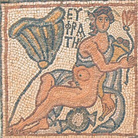
The Euphrates became a artistic theme in Christian mosaic art, as one of the four rivers in Paradise.