Danube (Greek ῎Ιστρος and Δάνυβις; Latin Danubius or Danuvius): one of the largest rivers in Europe, northern frontier of the Roman Empire.
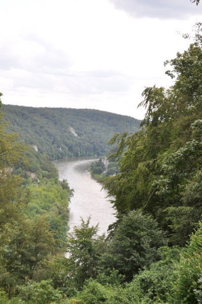
The Danube east of Regensburg
Springing from two wells in the Black Forest and emptying itself into the Black Sea, the Danube has a length of about 2860 kilometers. Among its many tributaries - Pliny the Elder knew sixty of themnote[Pliny the Elder, Natural History 4.79] - are the Iller, Lech, Altmühl, Naab, Regen, Isar, Ilz, Inn, Traun, Enns, Morava, Leitha, Rába, Váh, Drava, Tisza, Sava, Olt, Siret, and Prut. Passing through Germany, Austria, Slovakia, Hungary, Croatia, Serbia, Romania, Bulgaria, Ukraine, and Moldova, it is the second largest river in Europe - only the Volga is longer. The ancient authors believed that, except for the half-legendary rivers of India, only the Nile was larger than the Danube.note[Aulus Gellius, Attic Nights10.7.]
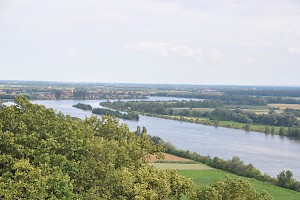
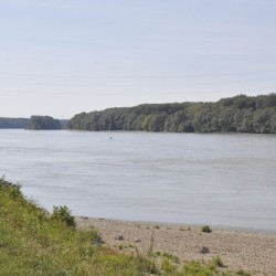
The Danube southwest of Kelheim
It certainly is one of the widest rivers known to the ancients. At Ulm, the Danube is about 70 meters wide; at Passau (ancient Batavis) about 200 meters; at Vienna (ancient Vindobona) 300 meters; at Budapest (ancient Aquincum) 560 meters; and, after narrowing at the narrow defile known as Iron Gate, it widens again until it is about a kilometer wide at the apex of its delta. The ancients recognized five or six branches.note[Herodotus, Histories4.47; Pliny, Natural History 4.79.] One of the islands was believed to be sacred to Apollo, another to Achilles. The fluvial deposits in the Black Sea are described by Polybius.note[Polybius,World History4.41.]
In the two sources, two little streams have their origin, today known as the Brigach and the Breg, which unite at Donaueschingen. The first real city along the river was Castra Regina (Regensburg), the base of the Third Legion Italica, a little bit beyond the place where the river became navigable for big ships. This was also the place where that part of the limes started that connected the Danube to the Rhine.
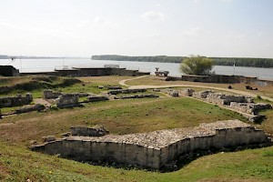
The Danube near Durostorum (the ruins are medieval)
All in all, ten legions guarded the river. As Procopius was to declare in the sixth century:
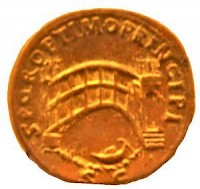
Coin with Trajan's bridge across the Danube
The Roman Emperors of former times, by way of preventing the crossing of the Danube by the barbarians who live on the other side, occupied the entire bank of this river with strongholds, and not the right bank of the stream alone, for in some parts of it they built towns and fortresses on its other bank.note[Procopius, Buildings4.5.2.]
Only two units, V Macedonica and XIII Gemina, had their base in Dacia north of the Danube. The emperor Trajan, who had conquered Dacia, also ordered his architect Apollodorus of Damascus to build a bridge across the river, the remains of which can still be seen at Turnu Severin in Romania.
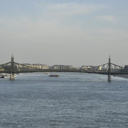
The Danube in Budapest
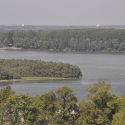
The Danube near Carnuntum
Belgrade, Confluence of Danube and Sava
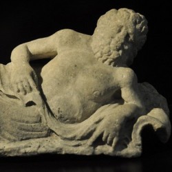
Carnuntum, River god Danubius
In other words, the Danube was, during the High Empire, the northern frontier of the Roman world. Of course the tribes were controlled indirectly. It had not always been like that; it was only during the reign of the emperor Claudius (r.41-54) that the legions were transferred to this river, one of the measures belonging to the Claudian army reforms. To the north of the Danube, the people were no longer Roman, but Germanic or Scythian.note[Pliny, Natural History 4.80.]
Before the Romans had reached the river, it was little-known, and the Greeks had two names: the western part, about which they learned from travelers who visited the Greek towns along the Adriatic shores, they called Danube, but the eastern part, which they discovered through Thrace, was known as Ister or Hister. Herodotus may have been the first to realize that the two streams were in fact one, and he said he believed that the sources of this river was in the far west, among the Celts, near the Pyrenees.note[Herodotus, Histories 2.33.]
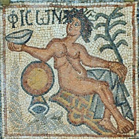
The Paradise river Pishon was often identified with the Danube (mosaic from Qasr Libya)
Because there is a peninsula called Istria in the Adriatic, it was initially believed that if you sailed up the Ister from the Black Sea, you could reach the Adriatic. The Argonauts were believed to have taken this route.note[Apollonius of Rhodes, Argonautica 4.389ff.] Later, the people realized that this was not possible, but even critical authors like Aristotle and the elder Pliny assumed that there was an underground connection between the Danube and the Adriatic, which was used by the tuna fish.note[Aristotle, Animal History8.13; Pliny the Elder, Natural History 9.53.]
According to Pliny, the catfish in the Danube were so big that they had to be caught with harpoons, and brought to the land with oxen.note[Pliny the Elder, Natural History 9.45.]Herodian was convinced that the river froze over every winter.note[Herodian, Roman History6.7.6-8.]