Nile
Q3392Nile (Egyptian Iteru, Greek Νεῖλος, Latin Nilus): one of the largest rivers of the world, dominant natural feature of Nubia and Egypt, famous for its annual flooding.
The river
Depending on the way one defines and calculates the length of a river, the Nile, which is more then 6,850 kilometers long, is either the longest river in the world or the longest river after the Amazon. With a drainage area of some 3,255,000 square kilometers in the northeastern part of Africa, it is the world's third biggest river, after the Amazon and the Congo.
The northern part of Africa consists, generally speaking, of the Sahara desert, which is inhospitable to human life. If the Nile did not offer a fertile corridor through this arid zone, it would be almost impossible to travel from subSaharal Africa to the Mediterranean and the Near East. This made the Nile a vital connection and makes the prehistory and history of Lower Egypt, Upper Egypt, and the Nubian kingdoms crucial for all of mankind.
Course
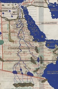
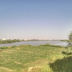
That the Nile has its sources somewhere in the big lakes of Central Africa was already known in Antiquity - the map of Africa in Ptolemy of Alexandria's Geography is the obvious example - but it was only in the nineteenth century CE that explorers were able to investigate the river's upper reaches. There are two main contributory rivers. The White Nile flows to the north from Lake Victoria (between modern Uganda, Kenya, and Tanzania), while the Blue Nile has its source in Lake Tana (in the highlands of what today is called Ethiopia). The ancients called these highlands the Moon Mountains.note The two rivers join at Khartoum in Sudan. Flowing to the north, the Nile reaches the southernmost of several shallow water rapids: the sixth cataract.
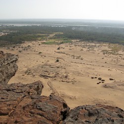
The river continues to the north, passes along the ancient Nubian capital of Meroe, and is joined from the southeast by the Atbarah river, which has its source near Lake Tana, not too far from the origin of the Blue Nile in the Ethiopian highlands. Having passed the fifth cataract, the Nile flows in a wide arch to the southwest and reaches, after the fourth cataract, Napata. Here was the Gebel Barkal, the sacred mountain of the Nubians. Before they moved their capital to Meroe, Napata was the main residence of the kings of Nubia.
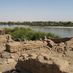
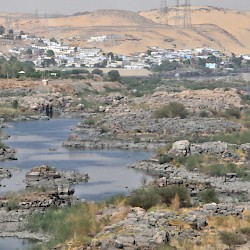
The Nile continues to northwest and north, and passes the third cataract and an island called Sai. After the second cataract, it enters what is now called Egypt. Near the first cataract were the city of Syene, which lies exactly on the tropic of Cancer, and the island of Philae. This area has changed considerably after the construction of the Aswan Dam.
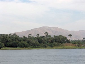
Continuing to flow in a generally northerly direction, the waters of the Nile passed along the capital of Upper Egypt, Thebes, and reached the pyramids of Giza and another Egyptian capital, Memphis (south of modern Cairo). To the southwest of Memphis was Lake Moeris, the modern Fayyum: a fertile wetland around a lake filled with the sweet waters of the Nile.
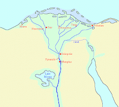
Memphis was at the southern apex of the delta of the Nile. The river used to empty itself into the Mediterranean Sea through seven branches; the land in between was called Lower Egypt. Alexandria is situated at the mouth of the westernmost of these, the Canopic branch. The six other branches were (from west to east) called Bolbitine, Sebennytic, Phatmetic, Mendesian, Tanitic, and Pelusiac. Of these, only the Bolbitine and Phatmetic are still recognizable; they are now known as the Rosetta and the Damietta branches.
In prehistoric times, there may have been an eighth branch, which connected the easternmost branch with the Red Sea. If so, it was silted up. In any case, several rulers have ordered the digging of a canal. According to Greek researcher Herodotus of Halicarnassus, king Necho I (r.610-595) gave orders for the construction, but it was finished almost a century later by the Persian king Darius I the Great.note This is confirmed by the Chalouf stele. The canal existed in Roman times.
 Khartoum, Confluence of the White and Blue Nile |
 Gebel Barkal, View of the Nile with Palace of Natakamani |
 Sai Island, View of the Nile with pharaonic town |
 Nile, First Cataract |
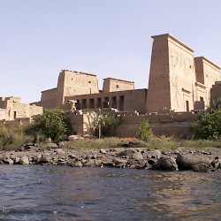 The island Philae |
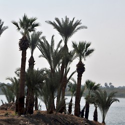 Karnak, Palm trees and the river Nile |
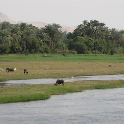 The fertile Nile |
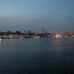 The Nile in Cairo |
Nile Flooding
The Blue Nile and the Athbarah rivers both originate in the highlands of Ethiopia, which witness heavy monsoon rains in early summer. These waters flow to the north, causing the famous Nile flood. The ancient Egyptians compared the flooding to the chaos of primordial times.
Not knowing the sources of the Nile, the ancients wondered what might be the cause of this phenomenon. Herodotus mentions several theories. That the northern wind blows back the waters and causes the river's ebb, as had been argued by Thales of Miletus,note he discards, pointing out that
there are many times when the winds do not blow and the Nile remains low,
and besides
if the winds were the cause, the other rivers which flow northward, should be affected like the Nile ... but there are many rivers ... behaving nothing like the Nile."note
Another theory was that the Nile flood was caused by the fact that it is not a real river but a branch of the Ocean. This had been argued by Hecataeus of Miletus, and Herodotus does not dignify this nonsense with a refutation.note He proceeds to dismiss another explanation, "the most plausible by far", offered by Anaxagoras of Clazomenae: melting snows. Herodotus points out that it is too hot in the deep south.note He finally concludes that summer rains must be the cause, which is correct.note
The Nile flood, which began in June in Aswan and reached the Delta about a week later, lasted for about five months. It was so important for the ancient Egyptians that they divided their year into three seasons: Flood (Akhet), Growth (Peret), Harvest (Shemu). (In fact, there could be more harvests.) They believed the flood to be perfect when the waters rose fourteen (or sixteen) cubits in Memphis. On other places, where the Nile valley was less wide, the waters could rise even higher.
Fertility
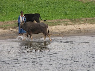
The Nile flood was extremely important for the Nubian and Egyptian economies. When the waters receded, the farmers found a layer of fertile sludge on their land. Pools and basins were quite easily to make and served to preserve the waters for later seasons. This made the land of the Nile one of those parts of the ancient world where agriculture was comparatively easy, with sometimes two harvests in a year. We know that the rulers of the Nineteenth Dynasty, the Ramessids, exported food and Egypt was to be the "granary" of Rome and Constantinople.
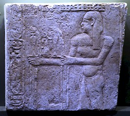
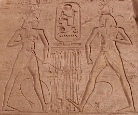
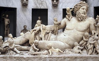
To indicate this fertility, the Egyptians portrayed the god of the Nile inundation, Hapi, as a man with woman's breasts. It was also recognized that the Nile sediments had created the delta; Herodotus estimated that this process must have lasted ten or twenty thousand years, adding the famous remark that the Egyptian land had been acquired from the river.note It was "a gift of the Nile".
Egyptian views
According to Herodotus, who says that no one knew about it except for the recorder of the sacred treasures of Neith in Sais, the Egyptians believed that the Nile had its source beyond the first cataract, between two mountains named Krophi and Mophi.note This is remarkable, because the Egyptian armies had reached Napata and at least some Egyptians must have known that the sources were beyond the fourth cataract.
Another story was that the goddess Satet of Elephantine (near the first cataract again) shot an arrow and that the blood from this wound caused the Nile to flood. This lasted until her daughter Anuket healed the wound. Other stories said that the Nile originated from the tears of Isis, who was weeping for her dead husband Osiris. Khnum, the deity of the first cataract, was seen as the lord of the flood. It would appear that the Egyptians were satisfied with mythological explanations.
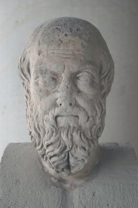
Greek views and Roman investigations
While Homer calls the Egyptian river just Aigyptos,note his younger colleague Hesiod was the first to call it Nile.note After Hecataeus, who works have not survived, Herodotus was the first to write about the Nile. He thinks it was symmetrical with the Danube, pointing out that both rivers divide a continent into two halves, and that their deltas are on the same geographical longitude. Since it was - according to Herodotus - well-known that the sources of the Danube were in the far west, in the Pyrenees, he believes that the sources of the Nile must be in the west too, in the Atlas mountains. And because the Danube has five mouths, two of the seven branches of the Nile must be canals.
For this theory he finds supporting evidence in an account, attributed to the people from Cyrene, that the people of the Siwa oasis knew about Nasamones who had crossed the Sahara desert and had witnessed a river with crocodiles and hippopotamuses in the deep south, beyond the Sahara.note Did they see the Niger?
For ages, this was to remain the standard view of the Nile, although there were competing theories. For example, the Macedonian and Greek soldiers who accompanied Alexander the Great to the far east, believed they had reached the Nile when they saw crocodiles in the river Indus.note The fact that the Indians were dark-skinned was believed to be additional evidence. Another theory, correct as we have seen, was that the Nile had its sources in the Moon Mountains, ie., the Ethiopian highlands.note
In 61 CE, the Roman emperor Nero sent out two centurions to Meroe and beyond. One of our sources, Pliny the Elder, thinks that this was in fact the preparation of a military campaign,note while Seneca, who is generally positive about Nero, thinks that it was a real, scientific expedition.note Having visited Meroe and proceeding along the White Nile, the soldiers reached the large marsh area known as Sudd.
Whether they managed to get beyond this point is contested, although Seneca's remark that the soldiers saw "two rocks from which an immense quantity of water issued"note may refer to the Murchison Falls, which means that the two centurions had proceeded beyond Lake Albert. In any case, the soldiers had more success than the philosopher Apollonius of Tyana who, according to third-century author Philostratus, set off for the source of the Nile but did not venture beyond the third cataract.note
In Late Antiquity, when the ancient world had become Christian, the Nile was identified with the Biblical Gihon, one of the four rivers of the Garden of Eden.note
Classical art
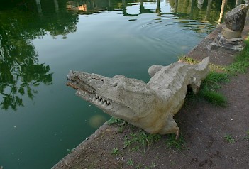
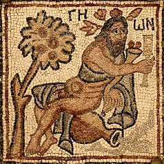
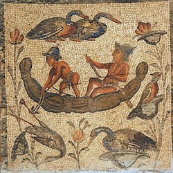
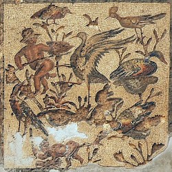
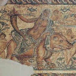
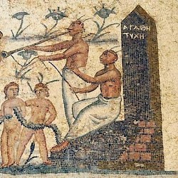
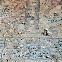
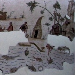
To the ancient Greeks and Romans, Egypt was a country full of wonders. They were fascinated by its large monuments (the monumental temples, the pyramids...), its animals (crocodiles, hippopotamuses, cobras...), its antiquity, and its unique ecological system. Because the life of the farmers in the country of the Nile seemed easier than the lives of their Greek and Roman counterparts, Nilotic scenes in classical art show a kind of Cockaigne, often decorated with Pygmies.
They are known from countless mosaics, found in, for example, the House of the Neptune Mosaic in Italica in Andalusia; the Villa Dar Buc Ammera and the Villa of the Nile Mosaic in Tripolitana, and the House of the Nile Mosaic in Sepphoris. Other representations are the Canopus in Tivoli, an idealized reconstruction of a Nilotic landscape made for the Roman emperor Hadrian, and various relief tiles from central Italy.
 Villa of Dar Buc Ammera, seasons mosaic, Nilotic scene |
 Villa of Dar Buc Ammera, seasons mosaic, Nilotic scene |
 Villa of the Nile Mosaic, second mosaic |
 Villa of the Nile Mosaic, second mosaic |
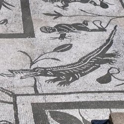 Italica, House of the Neptune Mosaic, Crocodile |
 Sepphoris, House of the Nile Mosaic, Nilometer |
 Carthage, Nilotic Mosaic |
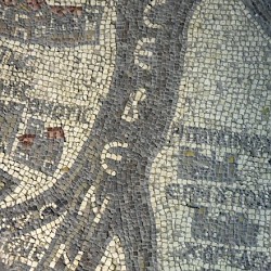 Madaba Map, Egypt, Sebennytic branch of the Nile |
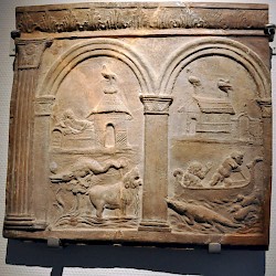 Campana plate with a Nilotic scene |
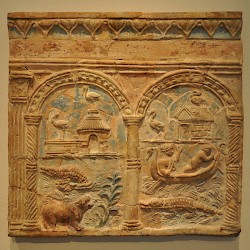 Campana plate with a Nilotic scene |
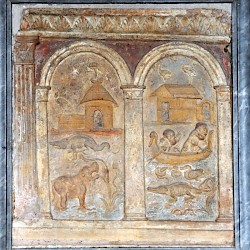 Campana plate with a Nilotic scene |
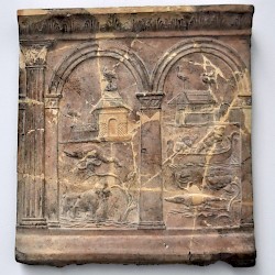 Campana plate with a Nilotic scene |